
Holy Crap… I’m in Parque Nacional los Glaciares!!!
My drive from Ushuaia with all the border crossings and the ferry across the Magellan Strait went just as smooth as before thankfully. I was a little worried about the ferry because they sometimes stop operating due to high wind, and this day was very windy, but apparently not too windy for the boats. Whew! I stayed one night in Río Gallegos again to break up my drive and the next morning I was off to my next stop, El Calafate. For the next few weeks I’ll be heading north along Argentina’s western border with Chile. It’s only about a three or four hour drive to El Calafate, so I had time for some exploring before settling in.

I headed into Parque Nacional Los Glaciares to see one of the most famous glaciers in the world, the Perito Moreno Glacier. This was an easy one. Just drive to the parking lot and then enjoy the big network of walkways with views of the glacier from every angle. By the way, this post is alternatively entitled “One Million Pictures of Ice Cubes.” I hope you’re all prepared.

The first picture above was from a viewpoint driving in. Once at the actual site, I started with the coastal trail littered with icebergs. What’s that? It looks cold? Yes, it was very cold and slightly rainy.

Once around the beach, the full glacier came into view. What an awesome sight! Perito Moreno Glacier is roughly three miles wide and stretches back about nineteen miles, which means I’m only seeing a fraction of it. It moves about six to seven feet per day and occasionally blocks this section of the lake causing flooding on the other side, at least until the water gets high enough to break the dam.


One thing that can’t be translated into pictures is the amount of noise this thing makes. It was rumbling and grumbling the whole time I was there and I saw several chunks fall off into the water. The chunks are massive by the way. In the pic above, to the right of the glacier and almost to the mountain is a little dot on the water. For scale, that’s a big catamaran that carries probably a couple hundred tourists.


This was a cold and wet excursion, but a great way to spend my first afternoon exploring the giant South Patagonian Ice Field. After this I went to El Calafate’s Glaciarium, the Ice Museum. I always knew glaciers were active and had a whole science to them, but I was never really interested enough to learn about them. I’m sure on top of it now though. After that I checked into my hostel, got some dinner, and prepared for tomorrow.

El Calafate is situated on the shore of Lago Argentino, the largest lake in Argentina. Lago Argentino with its arms stretching out really dominate the whole area, which means the only way to see most of the rest of the glaciers is by boat. So I bought a ticket for the Todo Glaciares tour and set sail.


From the port we headed northwest towards the Brazo Upsala section of the lake. The further we went the colder and rainier it got. The boat is a big catamaran and they pack as many people on there as they can. Our first stop was a giant iceberg, so people could have very expensive professional photos taken. I had to wade through a lot of people this day.


Further north we got an unexpected sight. A big chunk fell off another iceberg. Then we watched the whole giant thing rock back and forth trying to find it’s new equilibrium. It was still rocking when we left it.


The goal, or so I thought, was to get really up close and personal with the Upsala Glacier. Apparently the glacier is calving a lot and the pieces coming off of it are creating waves that are too much for the boats to handle. This was as close as we were allowed to get. Super zoom to the rescue. The Upsala Glacier ranges from six to eight miles wide and is roughly thirty three miles long. It must be quite something to see up close.

We turned around, headed a short distance south and then made a right turn into Canal Spegazzini toward the next stop. Along the way we passed by more icebergs and got a passing view of the hanging Seco Glacier. Who would’ve thought a bunch of ice cubes could be so interesting?


Finally we arrived at the Refugio Spegazzini, a big cafeteria/dining hall/viewpoint for lunch. This tour is actually two boats. I’m glad because you can hardly move on either of them they’re so crowded. My boat was first for lunch while the other boat went out to see the glacier up close (see pic below). I munched on my sandwich and empanadas and tried to enjoy the cloudy view of the Spegazzini Glacier and the Peineta Glacier running up to the right of it.


It was really cloudy and the views initially weren’t that great. While I was eating the clouds suddenly lifted and the sun sort of came out so I wrapped up the rest of my sandwich, threw it in my pack and ran out to the observation deck hoping to get pics before the clouds rolled back in. The pics above are from the observation deck. To the right of Spegazzini and Peineta was Cerro Heim with its own hanging glacier spilling miniature waterfalls down the slopes. I had no idea it was even there until the clouds lifted.


From the observation deck I got a pretty good view back to the opening of Canal Spegazzini too. After that I slowly walked back to the refugio to finish my lunch. I had about twenty minutes before re-boarding for my own up close encounter with all that ice.

The trip out to the glacier was awesome, aside from the wrestling for deck space part. It also brought the Peineta Glacier into much better view. Glaciers on top of glaciers! Amazing!

Spegazzini Glacier is just under a mile wide and covers about 83 square miles. It’s not the biggest glacier in the park, but it does have the distinction of being the tallest. The face of that big blue monster is over 440ft tall. Wow!


Finally, it was time to say so long to the Canal Spegazzini and settle in for the long trip back to the port. Luckily, the scenery was beautiful along the way.


Way in the southern part of the park is the Lago Roca section. Time for a hike. To get there I had to drive twenty five or so miles on one of the worst roads in Argentina. I think that’s saying something since I’ve driven so many of them. Eventually I reached my destination and started up to the Mirador Cerro de los Cristales. This was a steep hike, but not too long. At the top was probably one of the best views I’ve seen so far on this trip. The pics don’t even come close. In this first pic looking south you can see the Perito Moreno Glacier off in the distance, on the right.


Also, through that notch just to the left of center, I read you can see Torres del Paine National Park in Chile where I hiked about ten years ago. It was too cloudy this day, but it’s out there somewhere.

To be honest, I didn’t really even need to hike up to the Mirador. The whole hike up and down was exposed to that incredible view. In the pic below, that’s Lago Roca in the front, the Brazo Rico section of Lago Argentino behind it leading to the glacier, and the main body of the lake is waaay off to the right. Its a view too good for any camera.

On the way back to El Calafate I stopped at a viewpoint on the shore of Lago Argentino to take it all in.

Parque Nacional Los Glaciares is a huge park. So huge that I moved myself north to the hiking mecca of El Chaltén to finish exploring the northern part. The drive is only a couple of hours though, so I planned a little excursion on the way. First, look at those mountains! That’s where I’ll be hiking the next few days.

North of Lago Argentino is another big Patagonian lake, Lago Viedma. For this next bit I’ll need another boat. It was the same company as my other boat tour, but the boat was a LOT less crowded this time. Only about thirty or so people so there was plenty of room to breathe and move around.

The cruise took us across part of Lago Viedma. The first stop was to Cabo de los Hornos for a short hike to a rocky beach to see the Viedma Glacier. More ice cubes!


The Viedma Glacier may not look like much from this angle, but this is currently the biggest glacier in South America at 607 square miles. I say currently because the record holder used to be Upsala Glacier from earlier in the post, but Upsala has receded so much in the last several years that it got knocked out of the top spot.


After the hike we got back on the boat and sailed around Cabo de Hornos, in between some icebergs, and right up to Viedma Glacier.


Finally, it was time to head back. On the way back to the port I was able to spend some quality time on the deck enjoying the views of the lake. Thankfully, it wasn’t too cold this day and the sun was out. Along the way the captain passed by super close to a couple of the bigger icebergs. That was an unexpected thrill!


Now I can continue on into El Chaltén, check into my hostel and get ready for a few days of hiking. My legs are probably going to hate me after this stop.


My first hike was to Laguna Torre. The trailhead is actually right at the end of town, so I didn’t even have to drive anywhere. It’s so beautiful here no matter what direction you turn your head.


On the way up I could see my goal. That’s part of Glaciar Grande on the left, and part of Torre Glacier in that pocket on the right.

Aside from the glaciers and the lake, the main reason to hike up here is to see the Cerro Torre up close and personal. It was pretty cloudy this day and it rained a bit later in the day, so the Cerro Torre was a no show, unfortunately. It’s actually three spires and Cerro Torre is the one on the left. This pic below from a viewpoint about halfway into the hike was the best view I got of it all day. After that, the clouds completely obscured it.

Eventually I made it to Laguna Torre. Cerro Torre may be hiding, but there’s still plenty to see up here. That’s Glaciar Grande to the left again and Torre Glacier on the right in the pic below. Cerro Torre is right above it hiding in the clouds. I decided to extend my hike by going out to the Maestri viewpoint. It’s just over that ridge on the far right, also in the pic below.


I wasn’t expecting Glaciar Grande at all, I just came up here for Cerro Torre, but it was an impressive surprise and actually turned out to be the highlight of the hike for me. The panorama below was from about the halfway point to Maestri. Almost no one came out this far. Everyone else stopped at the lakeshore.


Also, way up near Maestri were two small side trails down into the forest to a couple of waterfalls. Bonus!


Those clouds obscuring Cerro Torre were starting to move my direction, so I decided to start heading down to not get caught in the rain. It was already starting. Back at the shore I spotted a new type of caracara that I hadn’t seen before, the White Throated Caracara. They were hanging around looking for food scraps.

The Laguna Torre hike clocked in at about thirteen miles round trip. I have one more monster hike lined up, but I decided to have an easy day in between, so next I drove out to Lago del Desierto. This was once a disputed territory between Argentina and Chile, but in 1995, Argentina won. Also, I know I said the road to Cerro de los Cristales was the worst in Argentina, but I found a worse road, the road to Lago del Desierto. Holy Crap! Twenty one miles of rocks, potholes, and suspension destroying, frustrating hell. It was bad. The views were amazing though, and I spotted some condors flying around.


The target here was to not only see the lake, but to hike up to the Huemul Glacier, a short two mile trek. A Huemul is an endangered species of deer, specific to southern Patagonia, by the way. I was really hoping to see one on this trip, but no luck. I’ll have to settle for the glacier. The stream on the way up was really beautiful and had lots of little cascades and falls. I also got lucky enough to get another pic of a woodpecker. Those guys are so freaking shy!


At the top of the short steep hike was Laguna Huemul and the Huemul Glacier. Such a pretty and remote spot. To see Lago del Desierto, however, I had to do a bit of scrambling over a ridge and then a bit of sketchy bouldering to get the view.


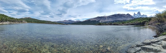
The star attraction in El Chaltén is Monte Fitz Roy, one of the most famous mountains in the world. To the right of Lago del Desierto I also got this view seen below. I didn’t even realize that was Fitz Roy that I was looking at. I had to ask about it at my hostel later. It also turns out this is like the third time I’ve seen it and I didn’t even realize it. Ha! I feel like such a dufus!


Here’s the whole mind blowing view in one pic. Lago del Desierto on the left, the view out to Fitz Roy kind of center, and Huemul Glacier (and the sketchy boulder field) on the far right. Tremendous!

On the hellish drive back I stopped at a couple of spots for waterfalls. The first one was just a random pretty spot. The second was the official waterfall, Cascada Cañadon de los Toros. I also got a couple more views of Fitz Roy. At least I know now that it’s Fitz Roy.


Next up was the big official hike to Monte Fitz Roy. This is apparently the most popular hike in all of Argentina. I believe it too based on the amount of people on that trail. I hit a few traffic jams going up and coming back. About a third of the way up you get to the first viewpoint. That glacier on the far right is the Piedras Blancas Glacier. More on that one later.


There were many views of the mountain along the way, but one of my favorites was from Cascada Escondido (lost waterfall), it’s lost on the most popular trail in the country because no one even comes down here to see it. Talk about a postcard! Yowza!

Finally, after a little over seven miles and over 3200ft of elevation gain, I arrived at Lago de los Tres staring at the face of Monte Fitz Roy. The last mile and a half of the hike was straight up. Once at the top, I was so tired that I almost didn’t care, I was just glad it was over. The sun also decided to come out and beat down on me right at the start of that climb, so that was nice.

I had some lunch and enjoyed that view for a while before deciding to head down. I had been watching the weather forecast very closely the last few days and I tried to plan this hike for the day that was least likely to be cloudy or rainy. Looks like it worked out pretty well for me. Awesome! Before going down the steep slope, I took one last look back.

The hike down was almost as grueling as the hike up. A little over halfway back I took the little side loop out to Laguna Capri. This was the perfect place to sit on the shore and take a break before finishing out the day. I also got approached by a beggar, but unfortunately, he showed up after I had finished my power bar. Too late lil’ buddy!


Almost to the end of the hike, and the views were still astounding. That valley and the Río las Vueltas were a welcome sight. With my side excursions to Cascada Escondido and Laguna Capri, this hike is just under fifteen miles and a bit over 3200ft of gain. Wow did I sleep good this night! Haha! This whole southern part of Patagonia is so beautiful everywhere you look it’s hard for me to wrap my head around it.

I still had one last day to explore Parque Nacional Los Glaciares and there’s two more things I want to see. First, the Chorillo del Salto waterfall. This one was really easy. It’s right on the edge of town and only about a five minute walk.

Next, I had to drive the hellish road again, but only about eight miles of it this time to the Río Eléctrico. This trail goes all the way up to Lago de los Tres too, but I’m only going up to the Piedras Blancas viewpoint today, about three miles one way.


The trail follows the valley and the river for a while before heading up into the forest. Once in the trees there were butterflies flitting around all over the place. It was kind of surreal.


Not even to the actual viewpoint yet, I got some great views of the Piedras Blancas Glacier, just hanging there. And of course, another angle of Monte Fitz Roy.


At the viewpoint I got another surprise. A great view of Laguna Piedras Blancas too. I knew it was there, I just wasn’t expecting to be able to see it. The waterfalls were a nice bonus as well.


Patagonia is a huge region, but when people talk about hiking Patagonia, this is the place they’re usually referring to. It shows too. I think there are more tourists here than locals, and the prices reflect that. Compared with all my travels in northern Argentina, my food budget has tripled here. Anyway, time to move on to the next stop. Stay tuned kids…